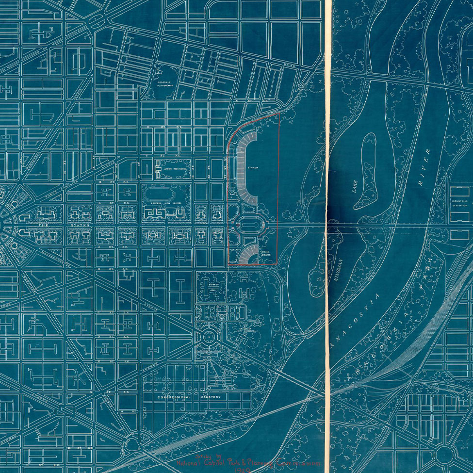
Planned Redevelopment Study of Part of the District of Columbia East of the (U.S.) Capitol
Author: National Capital Park and Planning Commission
Date: January 1929
PDF Source: Library of Congress
Description
This study envisioned an eastward extension of the National Mall that was defined by civic buildings, including a stadium at the Anacostia riverfront.
Reflecting earlier L’Enfant and McMillan Plan concepts and an interest in balanced growth, NCPPC introduced this concept at the 1928 national conference on city planning, which it sponsored. For the area east of the U.S. Capitol Building, NCPPC envisioned “a group of headquarters and exhibition buildings for each of the [U.S.] States, which might replace Statuary Hall in the Capitol.” Local groups suggested this ‘Avenue of the States’ development as a keystone of an upcoming 1932 celebration honoring George Washington’s birth.
At the corridor’s midpoint, a building group surrounding Lincoln Park would transform it into “Independence Square." This inspired the Beaux Arts Institute of Design to organize a competition in 1930 (see one submission). As a riverfront terminus for the corridor, NCPPC advanced a 100,000-seat stadium (see 1957 D.C. Stadium Act). While this stadium was never built, in 1961 the District of Columbia Stadium (later known as Robert F. Kennedy Memorial Stadium) opened on the riverfront site).
“This frenzied activity attracted wide—and overwhelmingly favorable—publicity” (e.g., see 1930 Evening Star article). Yet efforts to advance the vision (see 1941 Central Area Plan) sputtered amid the Depression and World War II. As the large, classically inspired Jefferson and Lincoln Memorials were constructed west of the Capitol, more nascent efforts in the east faced headwinds from what some called the capital’s “Romanization.”