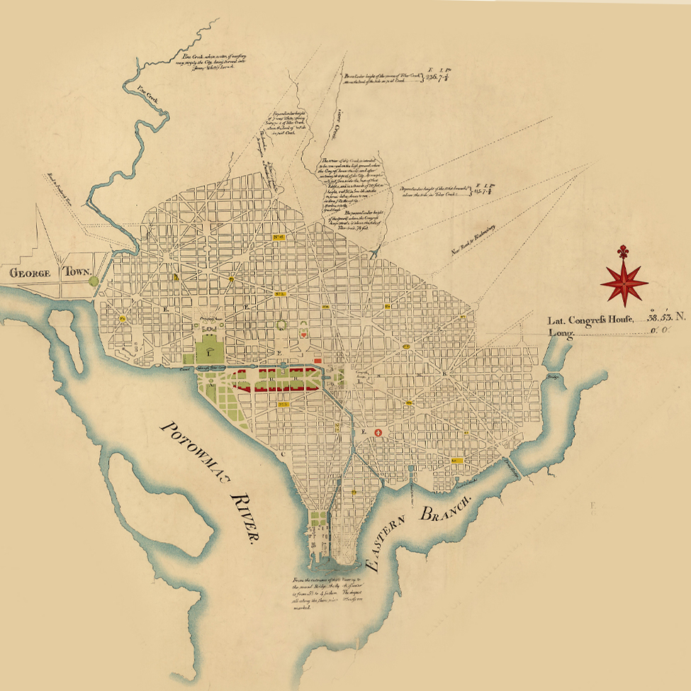
L’Enfant Plan of the City of Washington
Author: Pierre Charles L’Enfant
Date: January 1791
PDF Source: National Capital Planning Commission
Description
After Congress authorized a federal district along the Potomac River, President Washington identified an area of land measuring 100 square miles where the Eastern Branch (today's Anacostia River) met the Potomac just north of Mount Vernon, his Virginia home. The area already contained the port towns of Alexandria and Georgetown, but the new nation needed a federal center with space dedicated for government buildings. Washington asked L'Enfant, by then an established architect, to survey the area and recommend locations for buildings and streets.
This astonishing plan for the city continues to define Washington’s built form today. L’Enfant’s plan translates European models to American ideals. A central mall was designed as open to all (in contrast to European traditions of enclosed open spaces). L'Enfant placed “Congress House” on a hill with commanding views, rethinking European customs of reserving such sites for the leader's palace.
From this central site, diagonal avenues, later named after U.S. states, radiated, cutting across a grid street system. One diagonal avenue (later named Pennsylvania) extended northwest from Congress House to the “President’s House.” Public squares and parks were evenly dispersed at intersections. These wide boulevards facilitated cross-town transportation and offered long-distance views of important buildings and common squares.